 |
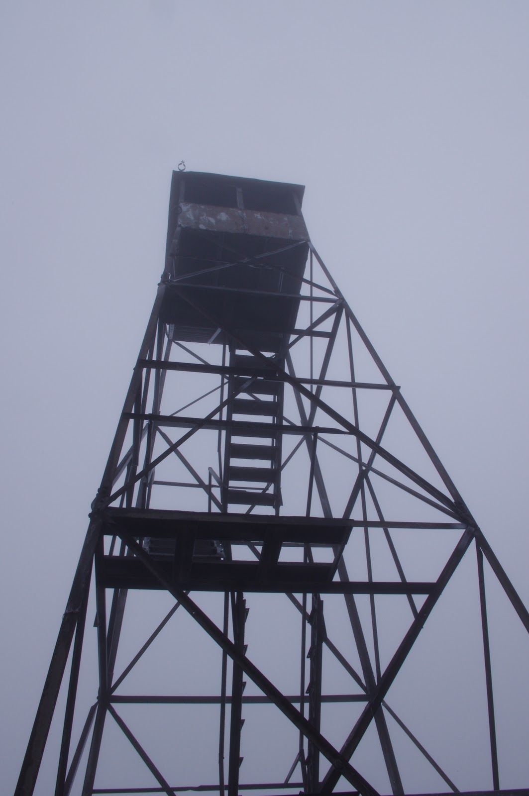
| The firetower on Hurricane Mtn. |
In an effort to keep my hikes close to home I've done a number of small hikes in the past week, almost all of which have been in or adjacent to the Hurricane Mountain Primitive Forest. For those of you unfamiliar with the terminology of forest units within the Adirondack Forest Preserve, the term "primitive forest" is used to describe an area that has most of the qualifications of wilderness, but cannot classified as wilderness due to the presence of man-made structures within the unit. The presence of a fire tower, built in the early 1900's, is the key reason for the area's designation as "primitive" rather than "wild". Firetowers are a controversial subject in the Adirondacks, causing an endless debate over whether they should be preserved for historical reasons, restored for recreational use, or removed to return the area to a "forever wild" state. I, myself, don't really have an opinion on this matter, as I see valid points from each side of the argument. Part of me supports the idea of keeping the Adirondacks as wild as possible, but another part of me recognizes that the fire towers are a key part of Adirondack history. A few years ago I helped with the restoration of the fire tower on Lyon Mtn., one of the few towers that are still maintained for public use. So I really can't pick a side on this issue, and tend to think there are far more important issues in the Adirondacks that we should worry about.
 |
| A dusting of snow on the old logging road |
On some mountains a fire tower is necessary in order to obtain a 360 degree view of the surrounding peaks, but on Hurricane Mt. no tower is needed for an amazing view. Many summits in the Hurricane Mtn. forest are bare rock at the top, a result of forest fires that ravaged the area in 1908, burning 20% of the forest preserve. The advantage to this is that many of these mountains, despite being only 2500-3500 feet high, offer astounding views of the greater mountain ranges around it. From the summit of Hurricane one can see the Jay Mtn. range, Giant Mtn. Wilderness, the Great Range, Whiteface Mtn., and the Green Mountains. Unfortunately the day that I chose to climb the peak last week afforded little in the way of a view, as a cold front of clouds and snow came rolling through as we made the ascent. The view was still impressive though, creating an ethereal view of Giant Mtn. as an island in a sea of clouds that would come and go as the clouds rolled past. While being able to see hundreds of peaks is always rewarding, there is something equally exhilarating about being in the clouds, surrounded in mist, watching a front roll in. Hurricane Mtn. tends to live up to its name by being extremely windy due to its isolation from other peaks, as I've experienced the other two times I've visited. But on this day the wind was calm, just an occasional light breeze pushing the clouds through, adding to the surreal feeling of being in the clouds. While we sat at the top a light snow began to fall, leaving a slight dusting on the trees that we admired on our way down the mountain. While I've always preferred any other season over winter, days like that are giving me a new appreciation for the season.
 |
| Ethereal view of Giant from Hurricane Mtn. |
There are three ways to ascend Hurricane--Crow Clearing, Route 9N, and Hurricane Mtn. Road. We chose the Hurricane Mtn. Road route, the least popular of the three. This trail starts on private land and traverses an old logging road for about a mile before it starts to climb. The trail was a little slick in spots due to ice, but overall very manageable. There was a large amount of fallen trees along the trail, some of which looked fresh from hurricane Irene, and some of which is probably from the ice storm of 1998. Whatever the cause, they had all since been cleared from the trail itself leaving no obstacles to climb over. Another friend of mine hiked the Route 9N trail the next day, the most popular route, and reported that it was very wet. Last year I hiked in from Crow Clearing, and I think this is the most scenic route. The trail crosses back and forth across a stream for much of the way before ascending through a thick balsam forest up to the summit. From this same parking area there are three other shorter hikes that can be added to a trip up Hurricane, or done on their own. Last year I hiked to Lost Pond after ascending Hurricane, a small picturesque pond perched on the side of the mountain. Yesterday I returned to that area to hike to Big Crow, a short but steep hike to an exposed rocky summit that overlooks Keene and the Great Range. It was another overcast day, but breaks of sun shone light on the valley below and made the ice-coated trees on the summit shimmer, creating some great opportunities for photos. From there one can continue to hike to Little Crow, about 400 feet below, but I chose not to do so yesterday because much of the bare rock descending Big Crow was covered in ice, making footing challenging.
 |
| View from Big Crow Mtn. |
 |
| Hurricane Mtn. from Owl Head Lookout |
One advantage to keeping the firetower on Hurricane is that it makes the peak easily recognizable from the top of other peaks. Last week I easily identified Hurricane from the summits of Baxter Mtn. and Owl Head lookout, two peaks that lie in the Giant Mtn. wilderness just beside Hurricane. Even though the firetower no longer serves a purpose, as its use was discontinued in the 1970's, it plays a part in the character of Hurricane Mountain, and I'm not sure the mountain would be the same without it.


Nice piece, and good photos. I fall firmly into the pro-Fire Tower camp, both on historical preservationist grounds, and, as you say, because they make it much easier to know what you're looking at. The idea that they should be removed to promote the illusion that these summits are a true wilderness is silly-- the trails are blazed with plastic disks, with directional signs at major trail crossings. I'm sorry, that's not a wilderness, even though it is wonderful that it is there, and is accessible.
ReplyDelete